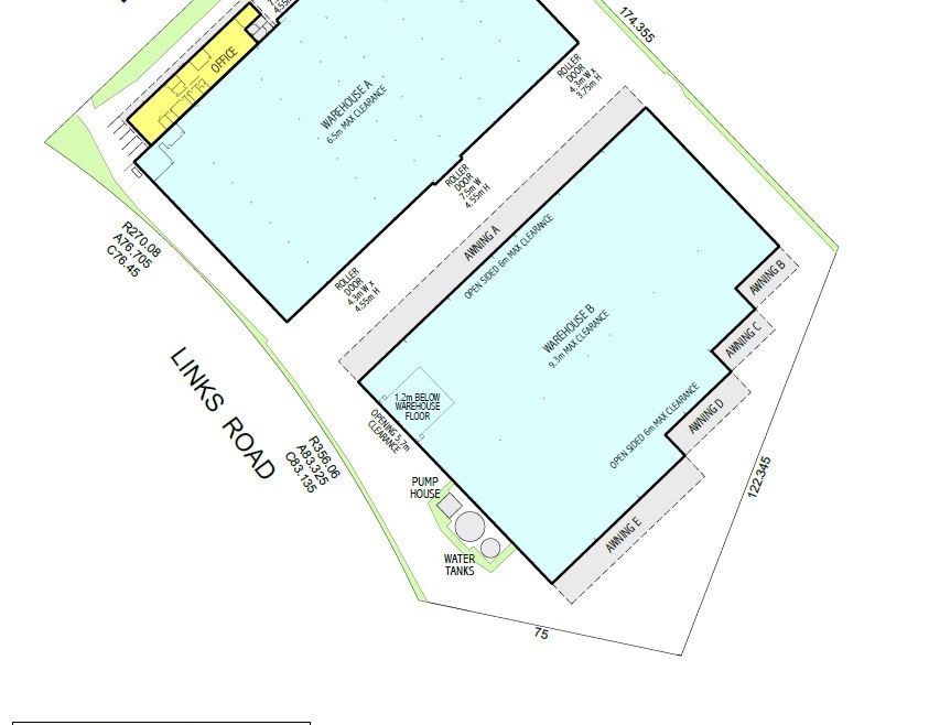
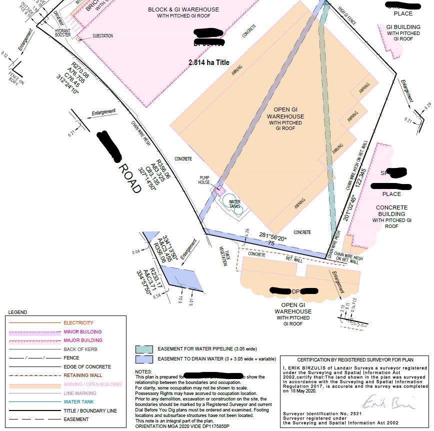
We were approached by a property consulting firm to complete both an identification survey and a Lease Survey for features and buildings on two sites and to provide the vendor Gross Lettable Area plans, Marketing Plans and an Identification Survey Plan.
Under the supervision of our Registered Surveyor we defined the land boundaries and easement locations and measured the location of all fencing and other occupation. The identification survey highlights any encroachments into or by neighbouring properties. The buildings were then were scanned with our 3D laser scanner and the data extracted from the resulting point clouds were combined with the external survey data to calculate Lettable areas using the guidelines set out by the Property Council of Australia and to produce Marketing Plans which the client can use for Sales/Lease purposes.