Photogrammetry Survey Solutions in Australia
Aerial photogrammetry for 3D plans and maps
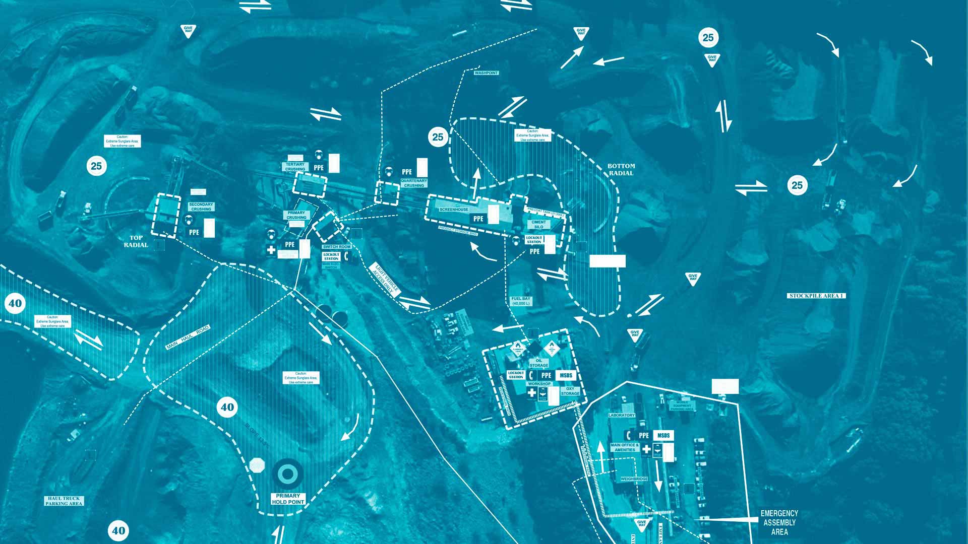
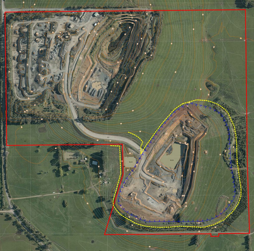
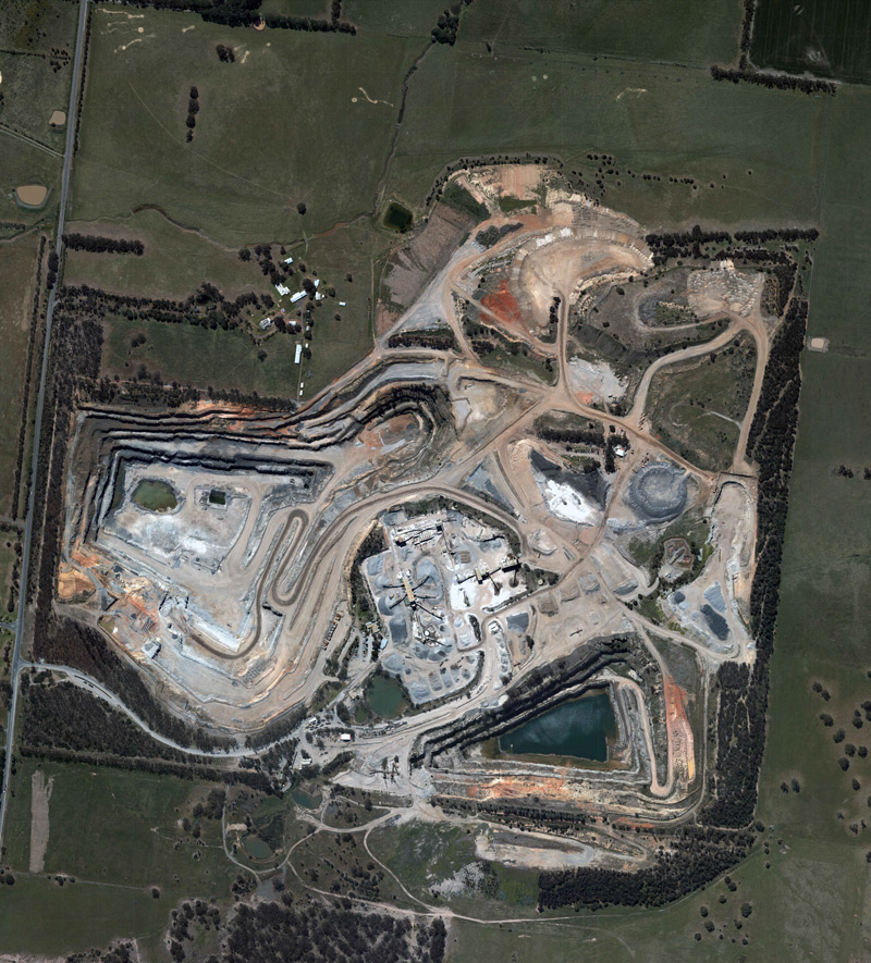
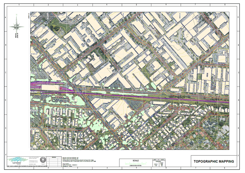
At Landair Surveys we work with clients Australia wide from our offices in Sydney, Brisbane and Melbourne offering aerial photogrammetry to prepare three dimensional plans and maps. The maps are used in planning and design of infrastructure such as highways, dams, windfarms, mines, quarries, landfills and for development projects. Photogrammetry is a great tool for measuring volumes.
Advantages of aerial photogrammetry over traditional ground surveying
- It is the cheapest and quickest way of mapping a large area,
- There are no site access issues,
- The photogrammetric map is a record of features and levels at an instant in time,
- Especially useful in rapidly changing sites such as mines, quarries and landfills.
Aerial photogrammetry sample gallery

Did You Know?
Photogrammetry refers to the process of recording, interpreting and measuring from photographic images.
For aerial photogrammetry we mount our camera in our aircraft and point vertically towards the ground. As the aircraft flies along a flight path, multiple overlapping photos of the ground are taken. These photos (called stereo photos) are processed using special software and hardware that lets an operator see two photos at once in a stereo view. This means that the operator can measure the ground surface and other objects in three dimensions.
Digital Elevation Models (DEM) such as digital surface models (DSMs) and digital terrain models (DTMs) can to be derived from stereo imagery.
A person specialised in undertaking this work is called a photogrammetrist.