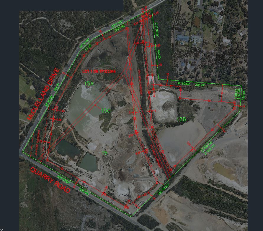
Burdett Sands came to Landair Surveys because they were uncertain about their extraction limit locations, and wanted to know where there extraction limits were on the ground and in relation to aerial imagery that we had taken for them 6 months prior.
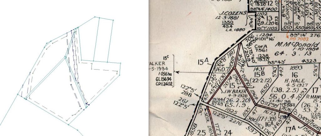
To do this, we needed to re-establish where the land title boundaries are. The title boundaries define the “Work Authority” boundaries for that quarry. In this case, some of the property boundaries were still Crown boundaries (unchanged and un-surveyed since the original Crown Grants were drawn up and sold in the early 1900’s) which come with their own challenges due to old and sometimes unclear plans and reports, along with the inaccuracy of the measurements taken in those days using mechanical theodolites, and chains to measure distances with.
Once we had accurately re-established the title/work authority boundaries with modern equipment and survey techniques/knowledge, we could then accurately place the extraction limits in relation to these, and go back out to site to place marks on or near the extraction limit to give the client a good understanding of where their limits are and allow them to better estimate how much material they have left to extract. We also gave them a digital version of their site boundaries which they can use for future works to ensure everything is on the same system/datum.