Our Surveying Solutions for Landfills
9 Surveying Solutions for Landfills
To help you streamline your operations, improve your profitability and plan for your future growth:
1. Need a Permit for Extension or a New Landfill?
We can help you get it faster by providing:
- Aerial photography;
- Existing conditions surveys;
- Landfill license plans;
- Title & easement boundary data.
2. Constructing New Cells?
We can help you construct new cells efficiently and to specifications by providing:
- Pre-construction surveys
- Accurate set outs
- QA of cell construction
- Scheduled UAV (drone) imagery
3. Thinking of Utilising Drone Technology in Your Landfill?
We can help you benefit your landfill operations by using drones to provide:
- Ortho images / site inspections
- Site surface models
- Volume calculations
- Point-cloud data
- Landfill thermal mapping
4. Need to Maintain Your Gas Infrastructure Records?
We can help you construct & maintain gas extraction systems by providing:
- As-built surveys of new gas lines
- Depth set outs for new gas wells & stake out of buried lines
- Proactive odour mapping of capped landfills
- Gas Management Plans for EPA reporting
5. Need Accurate Waste Volumes?
We can help you monitor landfill waste by providing:
- Net available airspace calculations
- Filled volume reports
- Cut / fill plans to top of waste design
- Waste set out surveys
6. Need to Anticipate Future Landfill Expenditure?
We can use your design files to provide a cell-by-cell analysis including:
- Initial cell earthworks
- Individual cell layer volumes & surface areas
- Cell waste capacities
- Rehabilitation soils volumes
7. Need an Efficient Data Management System?
We can help you create a single landfill site model containing all spatial data including:
- Previous / historical flyover images
- As-built landfill layers & topographic surveys
- Site infrastructure & utilities
- Design files
8. Thinking of Designing a New Landfill?
We can help with your initial, pre-design cost / benefit analysis using general industry guidelines by providing:
- Potential whole-of-life airspace
- Approximate landfill lining volumes & areas
- Estimated initial bulk earthworks requirements
- Approximate landfill capping volumes & areas
9. Require General Landfill Surveying Services?
We can use our vast landfill experience to make the day-to-day running of your landfill more efficient by undertaking:
- Regular aerial flyovers
- Topographic, construction, engineering, volumetric & cadastral surveys
- Asset recording (i.e. boreholes, sump levels, existing services, etc.)
- Cut / fill pegs
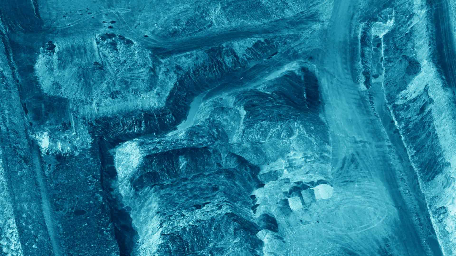
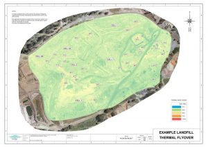
Landfill Thermal Mapping
At Landair Surveys we use state-of-the-art thermal cameras attached to drones to quickly and effectively identify potential landfill hotspot locations. Using surface temperature data stored in the drone imagery, a whole-of-site thermal map can be created to spatially locate high temperature readings requiring further investigation. This spatially accurate thermal map can also be draped across a site 3D surface to give a virtual, interactive view of the increased temperature locations.
Hotspot detection is an important aspect of landfill operations. Regular thermal flyovers of active and capped landfill cells can be a key tool in fulfilling EPA licence conditions. By proactively identifying hotspots before they turn into fires, the potential for large-scale remediation costs are significantly reduced.
Landfill thermal mapping sample gallery

Final Landfill Cap Conceptual Model
We offer our clients a vast range of 3D modelling tools to help visualize landfill surfaces by comparing asbuilt conditions and design profiles.
For this project, the client wanted to show the relevant governing authorities how the final finished landfill cap related to the surrounding landscape. Information markers and descriptions were placed within the model allowing the client to show important aspects of the model in their presentations.
Our Recent Projects
This project is a monthly drone flyover of a landfill cell for volumetric analysis. A total of 200 images were taken at an average height of 80m above ground level in a double grid layout. A total of 5 control targets were used to align the project to the site co-ordinate system with the alignment checked to 3 independently measured targets to ensure project accuracy.
A point cloud was created from the overlapping images. This point cloud was edited to remove surface ‘noise’ such as landfill structures, vehicles, plant etc. to create a digital terrain model (DTM) of the top of waste surface. Volumes were calculated comparing the monthly waste surface to the as-built base-of-landfill and final profile models to report on waste airspace consumed/available. A monthly ortho-image was also created to monitor cell compaction and filling patterns.
This new landfill site in regional Victoria has been four years in the making. From preliminary analysis to final asbuilt survey, Landair Surveys has worked closely with the local council’s waste management team to streamline the design and construction processes.
In late 2014 Landair Surveys was engaged by the local council to develop several preliminary landfill design scenarios for project cost/benefit analysis. Title re-establishment surveys were completed and an initial feature & level survey was undertaken combining land and aerial survey techniques. A best-fit landfill position, potential airspace, bulk earthworks volumes and individual landfill layer volumes were determined following industry design standards.
The chosen preliminary layer models produced by Landair were then used by the Council’s engaged engineers to fast-track landfill design and environmental reports for EPA Victoria.
Excavation began late 2016 and throughout the construction process Landair was involved in various drill-blast setouts, regular volume surveys, cut/fill analysis and construction checks.
The final asbuilt survey was completed mid-2017 and checks undertaken to confirm construction was within design tolerances. For stakeholder communication the model shown was created by draping the corresponding aerial ortho-image over the measured 3D mesh.
This project is a fortnightly drone survey for stockpile volumes at a metropolitan landfill. New landfill cell construction is underway and the necessary construction materials are being stockpiled on site for future use. The deliverables given to the client each fortnight are volume plans, stock increase/decrease reports and an ortho-image of the cell location.
For each flyover approximately 350 images are taken at a flying height of 110m above ground level. Using photogrammetry software, the overlapping images are used to create a dense point cloud of the cell area. The point cloud is cleaned and then decimated to a 50mm point spacing. A 3D mesh is then created from the point cloud and further refined for volumetric analysis.
This 3D model shows the key transitions a landfill goes through from a cell currently being filled with waste, to another cell in the process of being capped, to a finished rehabilitated cell.
The land survey was completed for EPA reporting purposes and a corresponding aerial image was used to create the textured mesh shown.
For this site, Landair Surveys also manages the client’s spatial data by creating & maintaining a single point-of- reference file easily accessible by the waste management team. All historical spatial data has been aligned to a common coordinate system and assigned to relevant layers for ease of viewing and analysis. Information such as design surfaces, site infrastructure, historical imagery, gas extraction lines, asbuilt cell records, etc. are stored within the data file creating a virtual landfill that can be viewed in 3D.
Further information on the services we offer for Landfills
Published articles
These articles originally appeared in Waste Management Review Magazine.
Are You Ready for the 2020 Shift? (39 KB)
As Australia transitions to a new coordinate system, there are a few key considerations for the landfilling industry to ensure it is prepared for change.
The Heat Is On (2512 KB)
We offer an aerial solution to identify landfill hotspots.
Adapting to the Conditions (536 KB)
Our case study of a recent landfill project where clay sideliner design needed to take into account legacy overhanging rock walls.
Dispelling Aerial Surveying Myths (1507 KB)
Why using both manned aircraft and drones for surveying can improve productivity.
Navigating Through Australia’s Landfill Data (196 KB)
Why a unified system of landfill spatial data could help operators save money and time when it comes to decision-making and auditing.