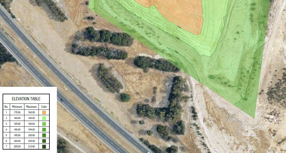
One of our quarry clients contacted us to analyse one of their quarries in Melbourne to find out the volume of the material that was extracted from below a specified reduced level. This was required to calculate payments for contractors. Using aerial photography, our photogrammetry team measured the landform and generated a digital terrain model and contours. Volumes were then calculated and an elevation heatmap was prepared by our CAD team. The heatmap provides a clear visual guide the areas that were below the reduced level.