One of our quarry clients requested Landair Landair Surveys to measure stockpile volumes for around fifty sites around Australia. Using our manned aircraft we captured stereo imagery of the sites. From the images our software creates a photogrammetric point cloud which gives us dense points of the surface of the quarries. These point clouds require careful cleaning to remove noise points such as trees, conveyors, plant and people. This cleaned 3D point cloud was then used as the top surface of the stockpiles.
To determined the stockpile bases, Landair Surveys measured the bases using standard stereo photogrammetric techniques. We have found that this is the best method for determining the true base of the stockpiles, especially when the stockpiles sit on uneven ground, sit up against banks, or where part of the stockpile is on top of a bank and part of the stockpile spills over the bank to the bench or floor below.
Once the base has been determined, stockpile volumes can be calculated between the base and the point cloud top. Some sites had up to one hundred stockpiles!
Using the combined techniques of traditional photogrammetric mapping for the bases and a point cloud for the stockpile tops enabled an efficient and most importantly an accurate workflow that meant volumes for all fifty sites were calculated within the tight timeframes required by our client.
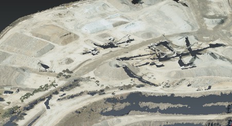
Raw Point Cloud 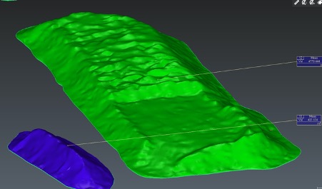
Stock Top Final Measured