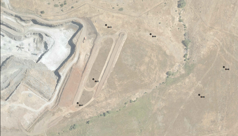
One of Landair Surveys quarry clients, had drilled some boreholes for testing the underground material in future stages of the quarry. They needed to know the location of these bores in relation to each other and the rest of the site using an Engineering Survey. This allows them to plot the core samples and get an idea of the underground geological layout for planning purposes and to determine resource volumes as they progress with the quarry. It also makes it much easier to find the bores again in the future if they need to refer back to them.
Landair Surveys were able to measure the location of these bores while we were on site for some other works, and provide Fulton Hogan with the coordinates of where these bores are, along with an associated plan/aerial image to make it easy to see where the bores are located.