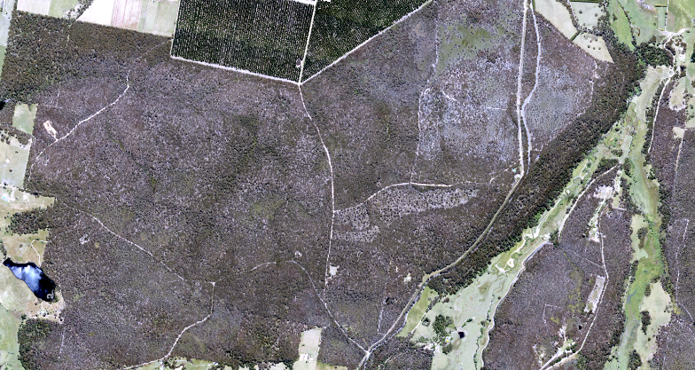
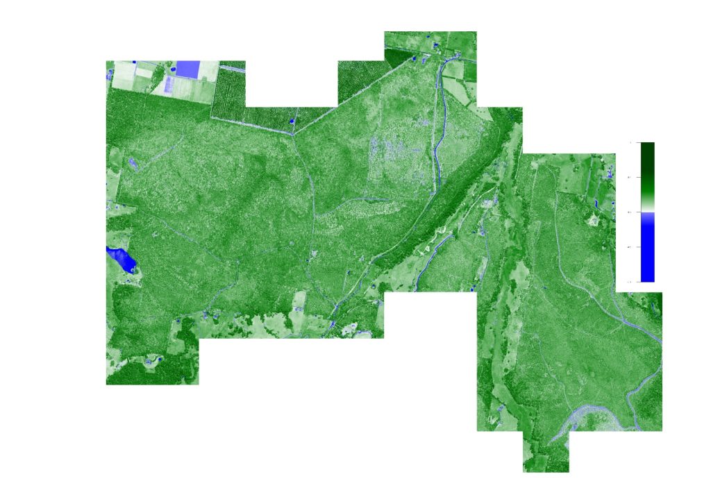
Our clients are mapping the extent of Phytophthora. This plant pathogen can spread easily, causing disease, death and potential extinction in susceptible plants, and loss of habitat for animals. The disease, Phytophthora dieback, is often difficult to detect and can cause permanent damage to ecosystems and landscapes before it is identified.
Aerial Photography using our specialised aerial camera captures the traditional Red, Green and Blue visible imagery, as well as a fourth Near Infrared band. Normalized Difference Vegetation Index (NDVI) quantifies vegetation by measuring the difference between near-infrared and red light.
Chlorophyll in plant leaves, strongly absorbs visible light for use in photosynthesis. The cell structure of the leaves, on the other hand, strongly reflects near-infrared light. The more leaves a plant has, the more these wavelengths of light are affected, respectively.