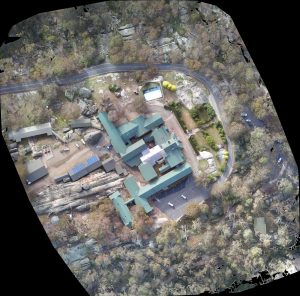
Our client required accurate spatial data of the internal rooms, external facades and the surrounding detail of the Mount Buffalo Chalet
We used a combination of data collection methods to get the detail they needed, including laser scanning, UAV flyover and traditional surveying around the building
Due to the elevation changes and large boulders, this made for a challenging area to work with, but using multiple sources of data we were able to get a good representation of the terrain in the area.
This data can then be used to design future restoration projects anywhere around the chalet