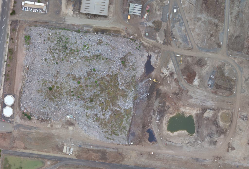
This week, Landair Surveys completed a UAV flyover for Ausdecom as part of ongoing works at their Lara site.
They were processing and removing waste from the site, and in doing so they needed to keep track of the volumes that have been processed and how much is remaining, while keeping in line with EPA requirements.
We assisted them by providing safe and efficient measurement of their stockpiles using an Unmanned Aerial Vehicle (UAV), meaning no one has to enter the hazardous area unnecessarily. A UAV is also known as a Remotely Piloted Aircraft System (RPAS) or a drone. Landair Surveys is a CASA-certified supplier of Remotely Piloted Aircraft (RPA) services for surveying and photogrammetry applications.
By completing a flyover and capturing a series of images, we were able to use sophisticated software to produce 3D point clouds from which we can extract surface and volume information, as well as provide up-to-date, high resolution orthographic imagery of the site.