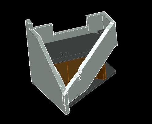
Landair Surveys was recently engaged by SPARK to undertake a Laser Scan Survey of a complex built structure and provide detailed 3D CAD model for the design of a unique water feature in North Sydney.
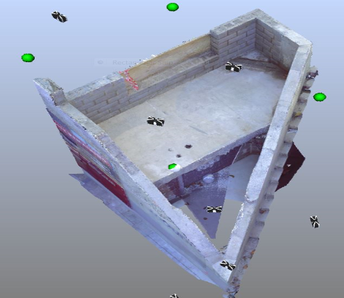
Our Trimble laser scanner was used to capture a complete 3D colour point cloud with an Accuracy of of +/-3mm which was then used to create a 3D model in AutoCAD so that architects could design and simulate fitting of the custom designed water feature prior to any actual fabrication.
The scan data was geo-referenced and Quality assurance checks were taken between total station measured points and 3D point cloud.
The end result means that the shop drawings for the water feature will be concise and accurate, reducing not only installation time but also saving the client on possible costly delays on modifications and/or re manufacturing.