%2520(1)-640x405.webp&w=1920&q=80)
Queens Bridge
Sector: Architects
Location: Melbourne, Victoria
Client: Conservation Studio
Services: 3D Laser scanning, Underground
Completion date: June 2025
Data: Point cloud, Plans


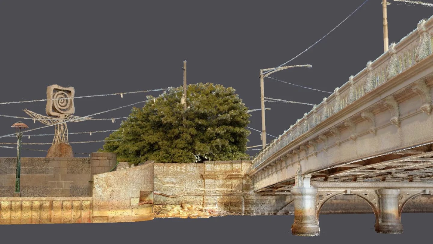

Landair Surveys was engaged by heritage architecture firm Conservation Studio to undertake a detailed existing conditions survey of Queens Bridge — a heritage-listed wrought-iron structure spanning Melbourne’s Yarra River. Built in the 1880s, this five-span bridge replaced an earlier timber crossing and remains a vital connection between the north and south banks of the CBD. A remarkable piece of infrastructure history, Queens Bridge was also the launch point for one of Harry Houdini’s famous escape acts in the early 1900s.
Working in a live traffic environment, our Melbourne team conducted mobile laser scanning of the bridge deck using the NavVis VLX3, allowing continuous data capture while navigating around trams, vehicles and pedestrians. The understructure was surveyed via boat at low tide, with the scanner worn onboard and multiple passes made beneath each span. Survey control was established on the bridge pylons to accurately align the top and underside datasets.
The result: a rich, colourised point cloud supported by over 750 spherical images and complemented by underground services data.
The final deliverables provide Conservation Studio with an accurate, high-resolution dataset to support detailed remediation planning of this significant heritage asset.
Services
3D mobile laser scanning (deck and underside)
Underground services investigation and plan
Key outcomes
- 3D colourised point cloud (60GB)
- 750+ high-resolution spherical images
- Integrated dataset of bridge deck and understructure
- Feature survey plan
- Accurate spatial data for remediation planning
More projects

