%2520(1)-640x405.webp&w=1920&q=80)
Point Hicks Lightstation
Sector: Architects
Location: Point Hicks Headland, Vic
Client: Conservation Studio
Services: 3D Laser scanning, RPA Flyovers, Feature survey
Completion date: 2023
Data: Point cloud, Façade elevation plans, Floorplans, Lighthouse section plan, Reflected ceiling plans, Roof plans, Feature survey plan, Subfloor beam plan, Roof cavity plan, Aerial imagery

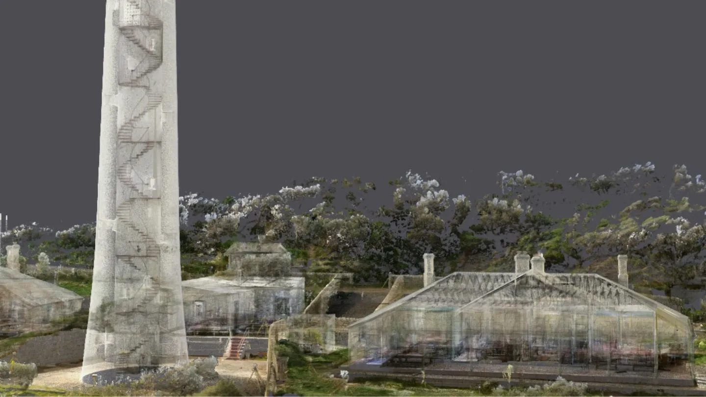


Landair Surveys was engaged by heritage architecture firm Conservation Studio, in partnership with Parks Victoria, to carry out a comprehensive existing conditions survey of the Point Hicks Lighthouse precinct — a historically significant and remote site perched on the edge of the East Gippsland coastline.
Built in the late 1880s and standing 37 metres tall, Point Hicks is the tallest lighthouse on mainland Australia. The site also includes two original timber residences — once home to the principal and assistant lighthouse keepers — as well as various ancillary outbuildings designed to support life in isolation. The headland itself is notable as the first documented sighting of the Australian continent by Captain Cook in 1770.
Following severe damage to road access caused by the 2019–2020 East Gippsland bushfires, access to the site was only possible by helicopter. The Landair team was airlifted in with all equipment, supplies, and provisions needed for the four-day remote deployment.
Once on site, the team undertook a full suite of survey activities, including terrestrial laser scanning, aerial drone capture and conventional measurement, to document every structural detail of the lighthouse, residences and surrounding terrain. Evenings were spent reviewing data in front of the fire in one of the historic keeper’s cottages.
Back in the Melbourne office, raw datasets were processed into a comprehensive suite of outputs to support future conservation and planning efforts. The final package comprised detailed 2D drawings, high-resolution imagery, and more than 150GB of point cloud data.
Services
Terrestrial laser scanning (lighthouse and residences)
RPA aerial mapping and high-res photogrammetry
Survey control establishment
Feature and level survey of precinct
Key outcomes
- 8 detailed sets of 2D plans
- 150GB+ of colourised point cloud data
- High-resolution aerial imagery
- Accurate spatial dataset to guide conservation works
- Complete survey coverage of an isolated heritage site
More projects

