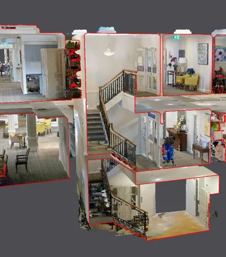
3D laser scanning
Captures millions of data points in the form of a point cloud, creating a precise representation of real-world conditions. This raw data set is then used to create the 3D models and digital twins that comprise BIM.
Why accurate data matters more than ever.
In the architecture, engineering, and construction industries, Building Information Modelling (BIM) is now central to how projects are designed, coordinated and executed.
By integrating data-rich 3D models into project workflows, BIM offers a single source of truth that enables better collaboration, risk mitigation and cost control. But for a BIM model to be successful, it needs accurate spatial data underpinning it.
BIM isn’t magic. If the input data is flawed, the entire model – and the decisions made from it – will be compromised. That’s why precision surveying is so critical.
BIM relies on geometric precision. Whether it's a new hospital, rail corridor or industrial facility, survey data defines the physical boundaries, constraints and conditions of the built environment.
There are several key surveying methods that feed directly into accurate BIM models:
Captures millions of data points in the form of a point cloud, creating a precise representation of real-world conditions. This raw data set is then used to create the 3D models and digital twins that comprise BIM.
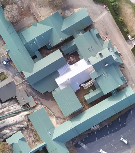
Delivers rapid and cost-effective topographic data and orthophotos – and is ideal for large or difficult-to-access sites. RPA is often used in conjunction with terrestrial scanning for complete site context.

Provides accurate survey pickups of key building structures and objects after construction – like steelwork and services. Like the name suggests, as-constructed surveys confirm that construction has been carried out according to design parameters.

Provides the high-precision control and georeferencing required to accurately anchor BIM models to real-world coordinates. Control surveys are critical for multi-staged projects and for aligning data across contractors and disciplines.
It’s not always obvious until it’s too late – but here are common signs to look out for to determine if the survey data feeding into your BIM model is flawed:
If these symptoms emerge, the likely culprits are:
Was the data georeferenced? Were control points validated? Was the scan resolution fit-for-purpose?
Overlay the original raw point cloud data onto the BIM model to try and identify the errors.
Especially if the site has changed or the original survey was conducted before demolition, remediation or enabling works.
A qualified surveyor, who’s experienced in correcting data, can identify root technical and spatial issues and fix them quickly.
While 3D modelling software has evolved rapidly, the need for precise, well-controlled survey data is just as important as ever. No matter how advanced your BIM process is, it lives or dies on the accuracy of the spatial foundation.
Architects, engineers and project managers who prioritise high-quality survey inputs reduce the risk of downstream rework, cost blowouts and coordination failures.
BIM is all about having confidence in what you're building...
Do you trust your underlying data? The BIM experts at Landair Surveys can capture the precision data that powers your project.
To discuss the laser scanning and modelling that will work best for your goals.